I’ve had a Garmin Colorado for quite some time now, and although it’s great, it’s really a pain in the ass to just enter a GPS co-ordinate and go there. I couldn’t find a simple, with-pictures guide online, so I thought I’d create one.
The fact of the matter is, you can’t simply enter co-ordinates. You have to create a waypoint at the current location, edit it, then navigate to it. Without further ado:
Step 1
Hold down the middle of the scroll wheel for a couple of seconds. The Colorado will inform you that it’s saved a new waypoint. Scroll down to “Edit” and press the middle of the scroll wheel.

Step 2
Scroll down to “Change Location” and click the middle of the scroll wheel.

Step 3
Enter to co-ordinates. The Longitude part will scroll in from the right when you get close.
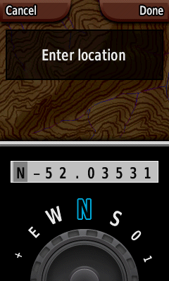
Step 4
When you’re done, press the right soft-key “Done”, then “Back”. You’ll be dumped back to the map. Press the right soft-key “Shortcuts”, scroll round to “Where To?” and press the middle of the scroll wheel.
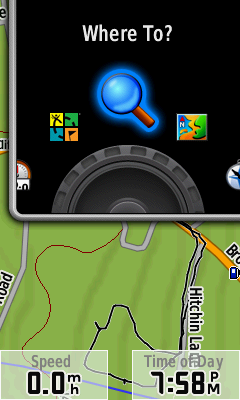
Step 5
Scroll down to “Waypoints” and click the centre of the scroll wheel.
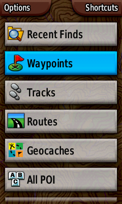
Step 6
Scroll to your waypoint and click the scroll wheel.
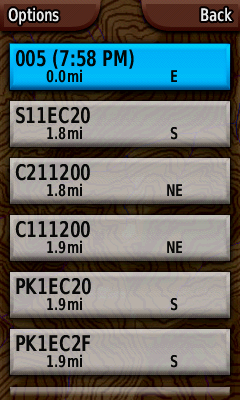
Step 7
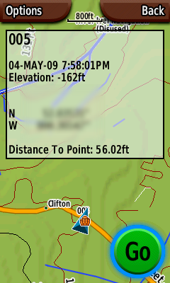
The Colorado will show the waypoint on the map. If this is enough, leave it on this screen and it’ll show your approach as you get close. Click the centre of the scroll wheel to begin navigation.
Step 8
There’s no step three! Wait…