Software that comes with devices, 90% of the time, isn’t even worth installing. iTunes is almost universally hated. TomTom HOME is awful. Anything written by Sony makes me want to throw my computer out the window.
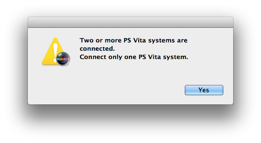
Yes! Sony’s PS Vita software seeing double and not communicating it very well.
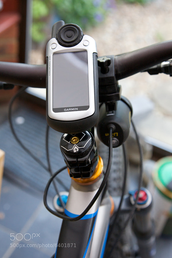
This is why I’ve had this expensive GPS unit — a Garmin Colorado — strapped to my bike for nearly four years and I’ve barely even looked at the software. In 2008, Garmin’s software was largely Windows-only and while the mapping application (MapSource) was certainly powerful, its UI was very late-90s Windows and incredibly unintuitive to use.
I ended up with a set of incredibly detailed topographic maps on a device with a 3” display and nowhere else. I certainly got use out of them, but mainly on the trail with my bike or out hiking, using them to decide which direction to turn when I came to a junction.
A few weeks ago, while researching Gamin’s latest outdoor GPS unit, the Garmin Montana, I discovered they’d released a Mac version of their newer mapping application, BaseCamp. I decided to give it a try and it instantly increased the value of topographic maps ten-fold, and has completely transformed cycling and hiking for the better.
You PAY for maps?! But Google Maps is free!
As I was tweeting about this as I was researching it, someone derisively pointed out that “There’s an app for that!”, likely free. And sure, topographic maps are expensive — the maps on my device that cover the section of Sweden I’m in (roughly 1/4 of the country) cost $199. However, Google Maps doesn’t even come close to offering the level of detail these maps do, and while OpenStreetMap is better in my area they still don’t match the quality and level-of-detail of these proper maps. Oh, and there’s no way in hell I’m strapping an iPhone to my bike’s handlebars!
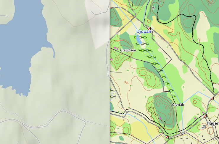
Google Maps on the left, 1:50,000 Topographic map on the right.
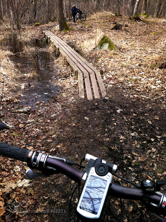
This path is on the topographic maps!
Using Garmin BaseCamp and Good Maps for Fun and Adventure
So, why is this so awesome? Well, BaseCamp has a superb map display, allowing you to virtually explore the paths and trails with ease and import logs of recent hikes and bikerides to be shown on the map.
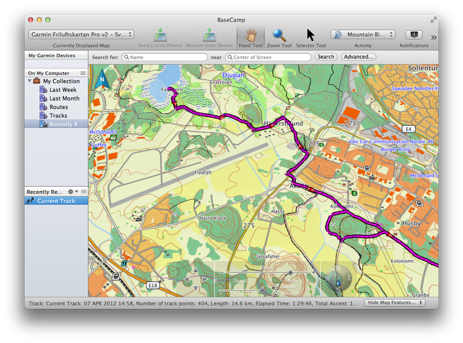
BaseCamp’s Map Display, overlaid with a track of a recent bikeride (magenta).
The software comes into its own when planning where to go, though. You can draw out potential routes on the maps and you’ll be given standard stuff like distance, but also a height map of the route. This is invaluable for planning outdoor treks — the route shown above was great fun because as the height map below shows, it’s paced nicely with each steep uphill part followed with a rest, and running it in reverse on the way home has a nice long downhill section to finish on.
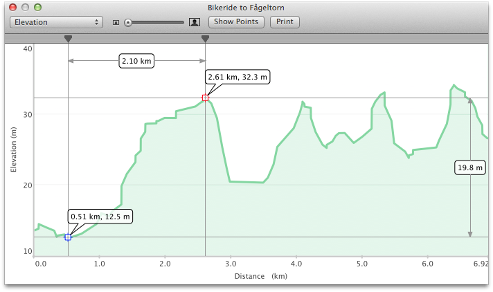
BaseCamp’s Height Map
As the quest to go snowboarding continues, this workflow is really helping me explore the countryside on my bike and have a lot of fun doing it. We’re going to the French Alps in the summer, and I’m really looking forward to getting maps of the area and going on some epic bikerides!